
San Blas Islands, today known as Guna Yala, is a semi-autonomous territory within Panama, inhabited by the Gunas. It has its own laws and regulations and receives support from the Pan government in terms of health, education and safety mainly.
Demography
San Blas Islands has a population of more than 31,557 according to the 2010 census.
Geographical Location
San Blas Islands is located on the coast of the Panamanian Caribbean. It comprises a strip of land of 145 miles in length and between 6 and 12 miles wide. The part of mainland has an area of ??approximately 1,238 mi2. To this surface is added the marine area, which includes reefs, cays, islands (more than 360) and fishing areas, only marine areas would have 847 mi2.
Summarizing all these areas. The San Blas has a total more than 2,085 mi 2.
For tourism advertising, it is common to hear that there are 365 islands and have used it very well for advertising: “an island for every day of the year”, but the reality is different, there is no exact number, but there are more than 300 Islands.
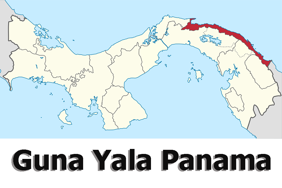
Limits

Limits to the north with the Caribbean Sea, by the East with the Republic of Colombia, by the South has 5 limits that are: Embera Region (Region of Cémaco), Darién Province, Wargandí Region, Madugandí Region and the province of Panama; at the west, it limits with the province of Colón (District of Santa Isabel). This is the part of the limit that the State imposed according to Law 16, at the moment is in conflict, since the Gunas do not agree with the same and they demand a part that historically they have worked and denominate Nurdargana.
Protected Wilderness Area of San Blas Islands
The area was initially declared by the Guna General Congress as the first phase of a Biosphere Region, by resolution No 3. of November 7, 1987, held in the community of Assudub.
Subsequently, it was declared on August 2, 1994, by the board of the National Institute of Renewable Natural Resources (INRENARE), today ANAM, by resolution J.D. No. 022-94. Which declares the Corregimiento de Nargana as the only Protected Wild Area established within the Comarca Guna Yala, and its extension is of 100,000 hectares almost one third (31%) of the total area of the continental territory.
Flora and Fauna

San Blas Islands covers 320,600 hectares of mountainous forests on the mainland, with more than 400 kilometers of marine-coastal area and an extensive archipelago.
The ecosystems of the Guna Yala Region are extraordinarily rich and are considered a high priority for the preservation of global biodiversity. Extensive forest areas make up a significant portion of the Mesoamerican Biological Corridor on the narrow isthmus. Forests have not yet been intensively studied by scientists and due to the very high rainfall gradient, a high degree of endemism is expected in Guna Yala Panama.
Vegetation and Biomes
Tropical moist forest, very humid premontane forest, very humid tropical forest.
63.5% Primary forest, consisting of land covered with forests in their natural state, without any human intervention.
12.4% Areas of protection, with intermediate conditions between primary and secondary forests.
6.0% Intermediate forest, the intermediate condition between primary and secondary forests.
13.3% Secondary forest, or lands that were runaway 10 or more years ago and in some cases up to 40 years or more.
4.8% Brushwood and temporary crop.
It is estimated that approximately 70% of San Blas consists of primary and secondary forest areas. A hundred different species of mammals (including the Andean bear of 200 kg), 30 species of reptiles and 440 species of birds inhabit this area.
The coral reefs of the Guna Yala Region are considered the best preserved on the Northwest Atlantic Biographic Coast and the Central Caribbean Bioregion.
Marine ecosystems
It has diverse ecosystems of mangroves, extensive networks of reefs and prairies of seagrass in shallow water of the continental shelf. There are 49 species of reef-forming coral and another 20 species in 11 vertical zones of reef settlement, one of the largest in the Caribbean. In spite of some disturbances, the coral reefs of Guna Yala Panama are considered among the 10 areas of the planet that still have reefs in good condition (STRI) 1993.
Relief

The topography is varied and irregular. The Cordillera de la Guna Yala falls to the coast, the plains near the shore, the islands, the Gulf of Guna Yala and the continental shelf.
The highest peak in the mountain range are Dianmaiayala (Brewster hill) 850 m, Obu 747 m, Ibedon 726 m, Demardakeyala 668 m and Galedyala 765 m.
Hydrography
In San Blas Islands, all rivers flow into the Caribbean. There are more than 20 large rivers. These rivers have relatively small basins, some of which do not exceed 15 mi in length. The rivers fall from the mainland to the ocean creating many falls, canyons, and rapids. Most rivers are flooded during the rainy season, but generally, most are clear as crystal. The rivers of San Blas are considered to be the best water quality in the whole of Central America. Thus, most Guna communities obtain fresh water from the rivers. At present some communities have built aqueducts from the main rivers to their island communities.
Governmental Political Division

For political purposes and positions of popular election at the national level, The district of Guna Yala is divided into two electoral circuits which are: circuit 10-1, from Gaigirgordub (Porvenir, not including it) to the community of Dadganggwe Dubbir, consists of 32 communities.
Circuit 10-2, from the community of Ailigandí to La Miel, consists of 19 communities. For this reason, it has two seats in the Legislative Assembly or two deputies. In 2008 they incorporated or joined the communities of the regions of Madugandí to the circuit 10-1 and Wargandí to the circuit 10-2; Within the electoral circuits of Guna Yala respectively, altering a little the organizational structure of the regions in electoral times. In addition, the region is divided into four corregimientos that are: Corregimiento No 1 Of Nargana. It is formed by 28 communities; Corregimiento No. 2 of Ailigandí, consists of 10 communities; Corregimiento No 3. of Dubwala, has 11 communities and the corregimiento of No. 4 of Puerto Obaldía, which has only 2 communities (it is a special corregimiento). This allows you to choose four representatives of corregimientos. These positions of deputies and representatives are more than figures of the partisan politics of the governments of turn and of the political parties; Although the Gunas participate in the national elections and vote in these figures, they represent the policies of the parties and not the interests of the Region.
Administrative and cultural political division
Onmaggeddummad Sunmaggaled (General Guna Political Administrative Congress) for the purpose of the sessions of its assembly, currently recognizes 50 communities formally, excluding Gaigirgordub (Porvenir); Including Puerto Obaldía and La Miel, these communities can send their delegates but are taken into account as a community.
Onmaggeddummad Namaggaled (General Congress of Guna Culture) Sectorial, it is divided in Daragwaned that would be the sector of the west or west (that corresponds to corregimiento No.1, also known like sector of Carti); Neg abargined, corresponds to the center and dadnaggwe that is the east sector.
In total there are 51 communities that make up San Blas, including La Miel. Two communities are in the jungle, which are Mandiyala and Gangandí; 11 are located on the coast or mainland, the so-called coastal communities; That means that 38 are in the islands, of which six communities share the same island (3 islands), but with two administrations which are: Urgandí and Mammardub, Usdub and Ogosuggun, Sasardi Muladup and New Sasardi. Although at the Culture Congress he had always participated, Dadargwane Mammidub (or Carti Mammidub) was the last community to join the administrative political Congress.
The governmental structure of Guna Yala is defined in The Organic Law 16 of 1953. The General Congress Guna is the highest political authority of Guna Yala, consists of representatives of all communities of Guna Yala and meet twice a year. The votes are taken by every saila of the community, which are 50 gunas communities.
Finally, before to end the San Blas Islands article, I would like to thank the students of the degree of Sustainable and Community Tourism Development of the Faculty of Humanities of the University of Panama and the Guna General Congress, for having provided the material in a summary and precise way.


